
Ireland's motorways
The M50: the busiest motorway in the country
The M50 was built in sections over more than forty years, and is now a substantial piece of infrastructure on the edge of the capital. Here is how to read it — from its junctions to its tolls — and what you should know before you drive on it.
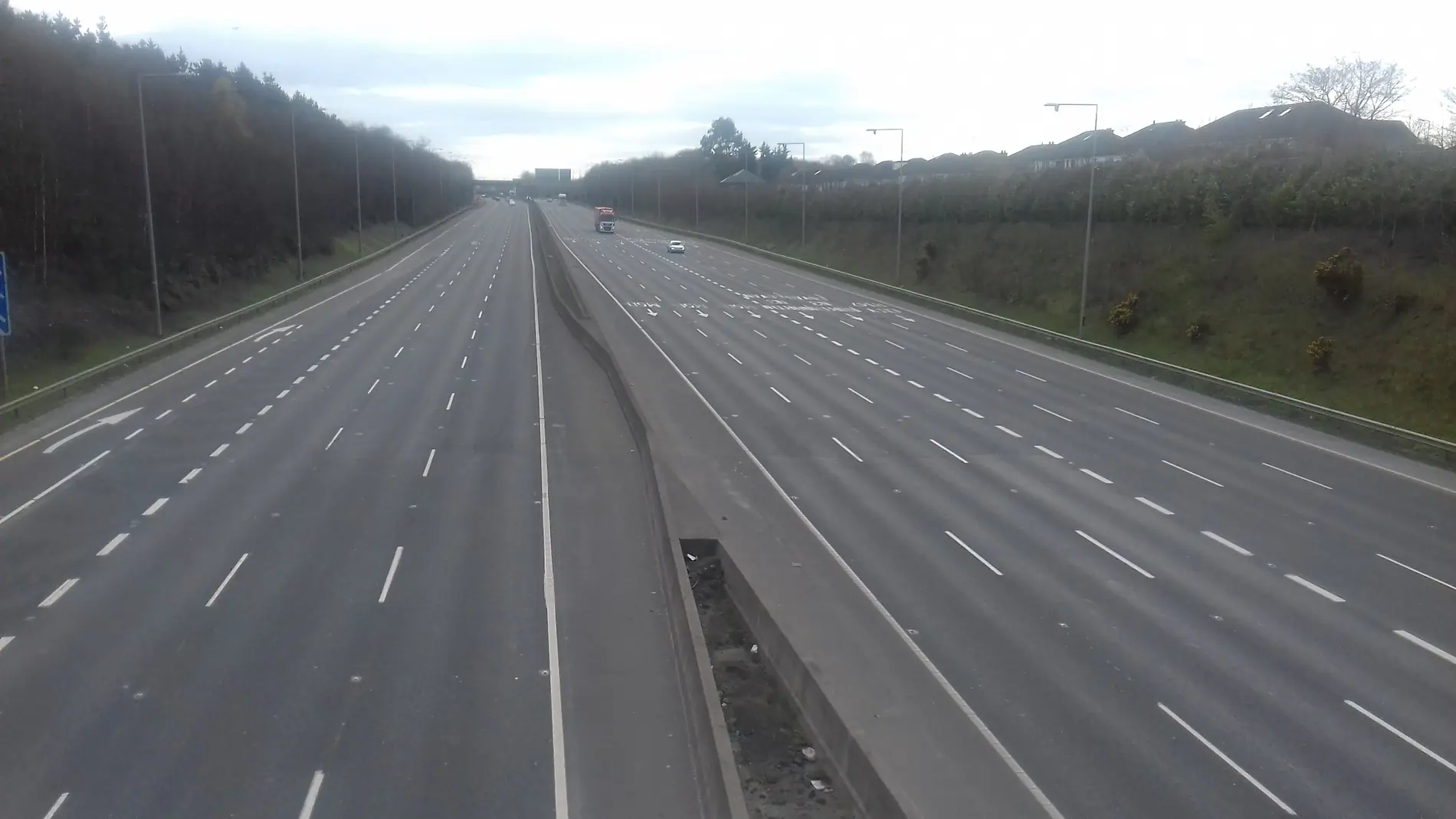
A view from the junction 6 bridge on the M50, looking south. Photograph: Laurel Lodged (CC BY-SA 4.0), via Wikimedia Commons.
If there is one road in Ireland that can be offered as a case study in how a motorway works, it is the M50. Not only is it the busiest route in the country — it forms a ring around the capital, which means it has no single destination. People drive it going from south to north, from the airport to the port, and from the suburbs into the city.
Understanding the M50 begins with three simple questions: what exactly it is, how it came to be, and what the signs and tolls you see on it mean. This article answers all three without straying into details that cannot be verified.
What a motorway is
A motorway is a kind of road with rules of its own. It is not simply a “big road”: certain classes of traffic are banned from it, the two directions are physically separated, and its junctions are grade-separated rather than at grade. In the most basic sense, a motorway is designed so that every movement is forward, with no direct crossing of opposing traffic.
The letter M is used to denote a motorway in Irish road numbering, and N for a primary national road. A road can be a “motorway” without forming part of the M network — though in practice the two usually refer to one another.
How the M50 came about
The M50 was not built whole at any one time. The first section was begun in the 1980s and opened in 1990, and it continued in sections into the 2000s. Some of the latest pieces were added in the early 2000s, and the route was extended to the port when the Dublin Port Tunnel opened in 2006.
Between 2006 and 2010 there was a major upgrade: extra lanes were added along some sections, and free-flow junctions replaced several of the roundabout junctions that had stood there before. The result of that process is a road that is, in places, wider than anyone seeing it for the first time would expect — this is the way infrastructure grows.
A motorway can be a corridor and a boundary at the same time. What changes is why people are on it.
Junctions and how to read them
The M50's junctions are numbered, and they are part of the larger system of signage that is needed to use the road with confidence. When you see “J6”, it means junction six. This numbering is useful not only for finding your way but also for giving someone else context if you are describing a place.
Each junction has corresponding signs: the junction number, the nearest destinations, and often the class of road it connects to. They are read from left to right and from top to bottom, and the first line is usually the thing nearest to you.
-
01
Find the junction number
You will see it on the large signs before the junction and on the small signs at the junction itself. Note it early.
-
02
Read the first line of the sign
It is usually the most important destination. You need not read every line if you are following the main road.
-
03
Keep your lane to continue
If you are continuing straight through, stay in the lane furthest from the exit. You do not need to change lane in order to carry on.
Tolling: what it means
The M50 has an electronic tolling system at some of its junctions. There is no need to stop at a gate; payment is accepted through advance registration or through a device fitted to the vehicle. More detail on the system itself is given on a separate page, since the rules and the deadlines matter more than the underlying idea.
The most important thing to understand is that the toll is a charge for the use of the road, and that it is subject to regulations we cannot alter or promise. If you are planning a journey, check the official site for the current rates.
Related material
We have a separate essay on tolling and charges, and on Ireland's tunnels more broadly.
A day on the M50
If you watch the M50 on a working day, you will see a clear pattern: traffic comes in during the morning and goes out in the evening, and the two directions differ in the volume they carry. That is no surprise, but it is worth noting if you are planning a journey on which you do not intend to reach the city at all.
At the weekend the pattern changes again: there is more movement between the towns and the coast, and less traffic heading into the city. No online account can forecast these patterns precisely, but they can help you set your expectations.
Signs and rules
Ireland's signage system is based on international signs, but with some local differences. On the M50 you will see green signs for the motorway, and white signs for other roads. Colours are used to indicate the class of road, and symbols are used to indicate the kind of hazard.
The most basic rule is that the M50 is a motorway, and certain classes of traffic are therefore prohibited on it. You must be aware of the speed limits in force and keep to them — you must also be able to respond to variable signs showing lower limits or warnings.
This is not safety advice
What is described here is the kind of signage that exists, not how to drive. Always follow the physical signs and official instructions.
When the M50 stops
The M50 is so central that a single incident on it affects a far wider network. The closure of a few kilometres can cause congestion on roads far away. This is something regular drivers understand well, and it is worth remembering for anyone who is visiting.
From the reader's point of view, this means the M50 should be seen as part of a network, not as a single route. If you are travelling from the south to the north of the country, another way might prove easier, even if it is longer.
Frequently asked questions
Is the M50 a motorway for its whole length?
The M50 is designated as a motorway for most of its length. It is, however, designed as an urban ring, which means its junctions are closer together than those of a rural motorway.
Do I need to stop to pay the toll?
Usually you do not stop. An electronic system is used, and payment is made through registration or through a device in the vehicle. The details are on the tolling page.
Can I use the M50 by bicycle?
No. Certain classes of traffic are prohibited on motorways. Other routes exist for bicycles, and some of them connect with the east coast.
When is traffic heaviest?
Traffic is usually heaviest during the morning and evening business hours. We cannot promise exact times; check official sources.